India's Trusted Land Surveyors — Precision in Every Coordinate.
From Chennai to the Himalayas — and overseas — LDR Survey delivers topographic, drone, DGPS and land valuation services for India's largest infrastructure, industrial and residential projects.
Trusted by India's Leading Builders & Government Bodies
When India's biggest projects need centimeter-perfect ground truth, they call LDR Survey.
For 25 years we've been the surveying partner behind India's largest infrastructure, industrial parks, residential townships and government mapping projects — trusted by L&T, Tata, Adani, NHAI and 500+ corporate clients across all 28 states.
DGPS, total station and DGCA-licensed UAV fleet calibrated for sub-cm precision.
Reports accepted by SBI, courts, DTCP, CMDA and state revenue departments.
80+ field engineers and 150+ drones — mobilized to any site in 48 hours.
Our Core Expertise
State-of-the-art surveying solutions tailored for Indian engineering, legal and regulatory requirements.
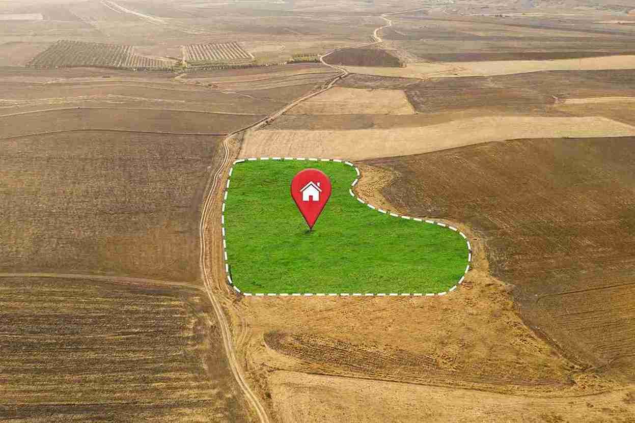
Land Survey
Accurate plot, parcel and boundary surveys for residential, commercial and agricultural land.
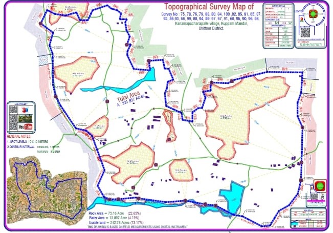
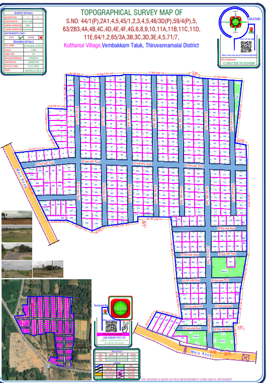
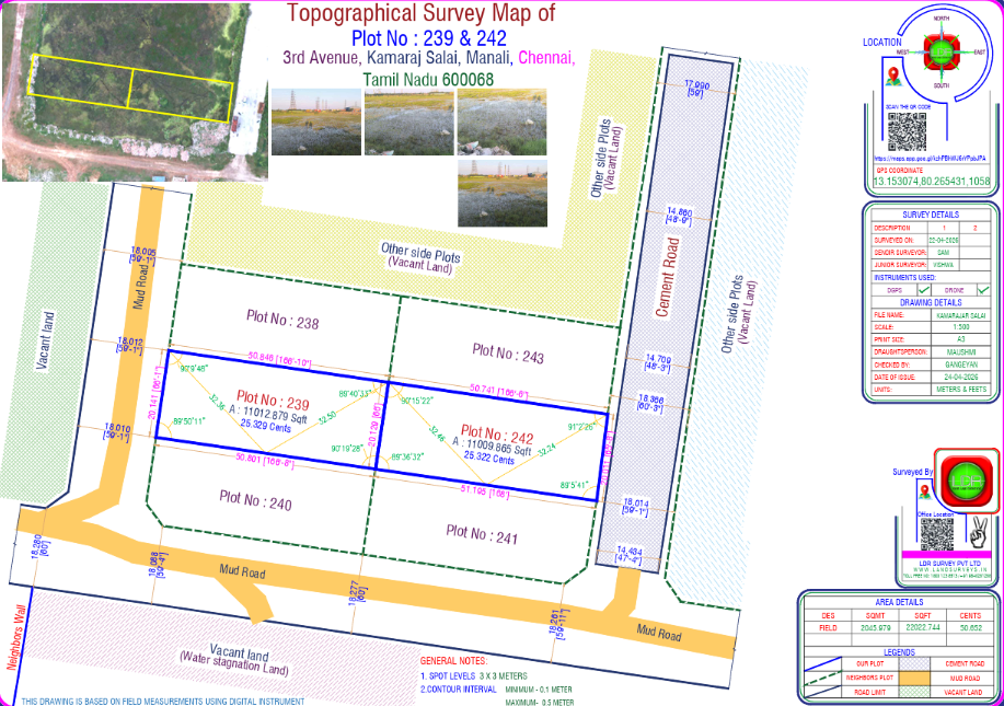
Topographical Survey
Detailed terrain mapping with spot levels, contours and feature plans for site planning.

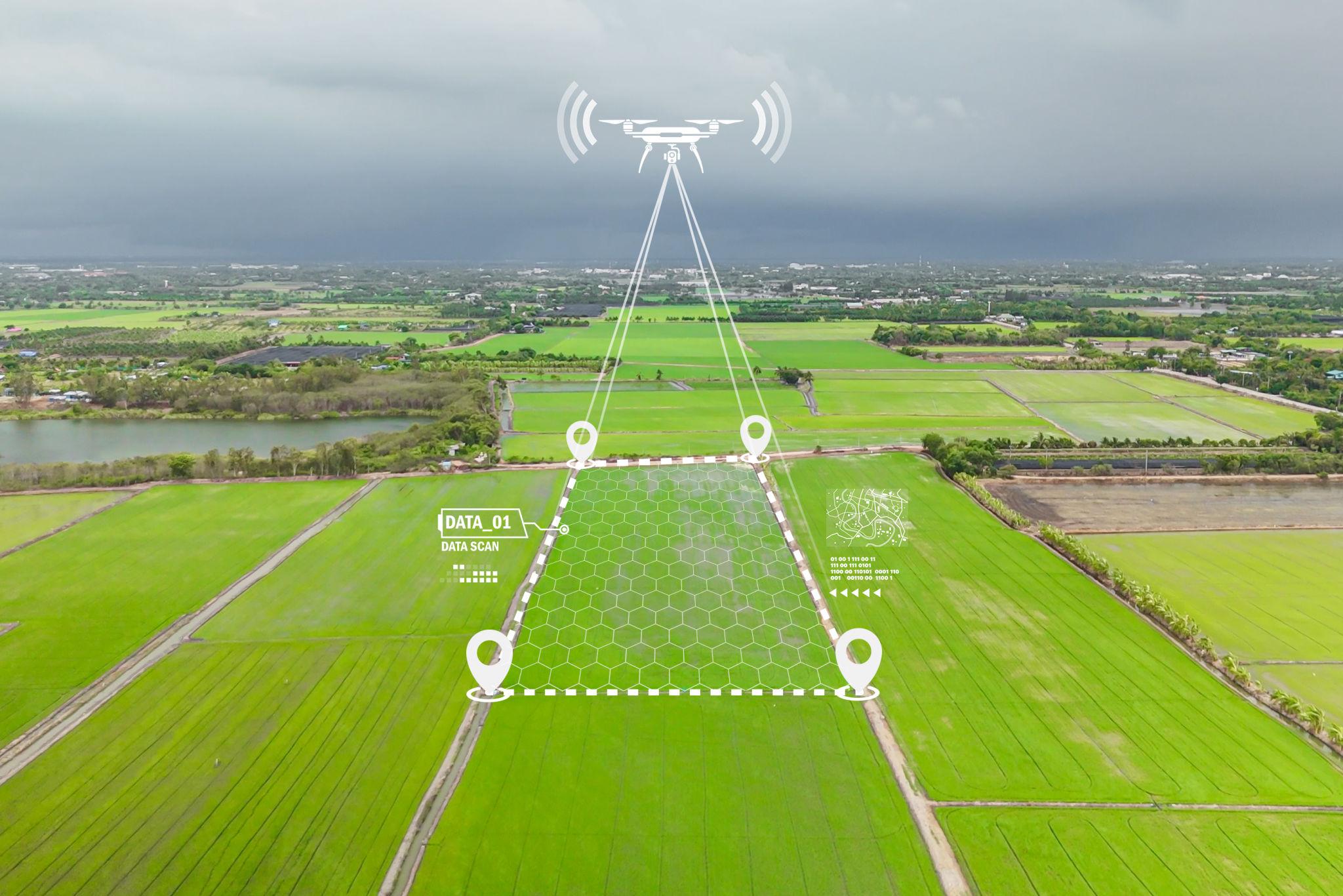
Drone Survey
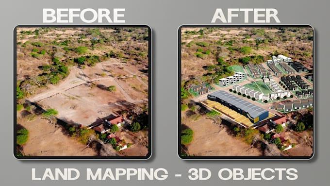
DGCA-licensed UAV surveys producing high-resolution orthomosaics and 3D terrain models.
Property Survey
Verification of property limits, encroachments and revenue records for buyers and owners.
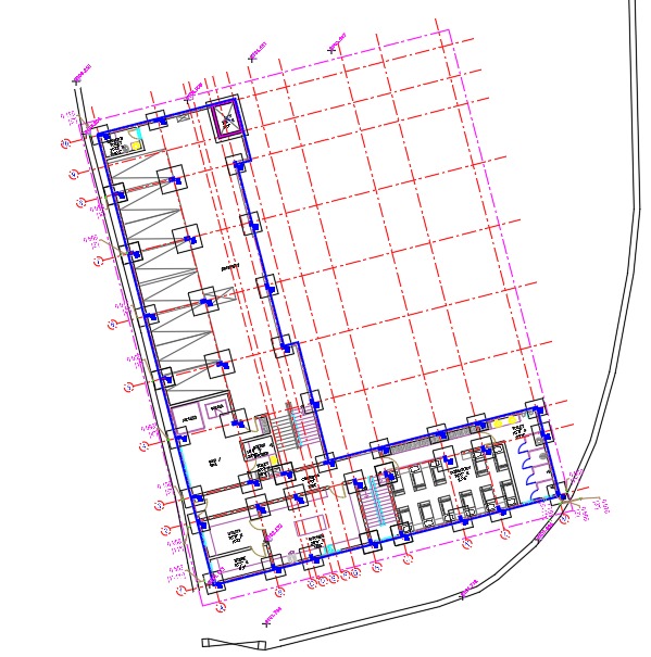
Layout Survey
Plotting and demarcation of approved layouts for builders, developers and DTCP submissions.
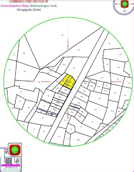
Combined FMB Sketches
Combined Field Measurement Book sketches aligned with revenue records for legal clarity.
Land surveys delivered across India.
2,000+ Acre Industrial Mapping in Sanand
Deployed DGPS technology and DGCA-licensed drone fleet to deliver complete topographical layout and contour map for a major chemical manufacturing zone — in 45 days flat.
4.9 / 5 from 480+ verified clients
"Engaged LDR for a 12-acre site survey near OMR. Drone mapping was completed in 2 days with detailed contour plans. Highly recommended for builders."
"Professional team, accurate DGPS boundary survey for our farmland in Hosur. The legal documentation they provided made registration smooth."
"Used LDR for land valuation on a 5-acre commercial plot. Their report was thorough and accepted by SBI without any queries. Great experience."
"Very impressed with the 3D drone survey for our industrial project in Sanand. Quick turnaround and accurate output. Will hire again."
Ready to begin your next project?
Get a free site visit and quote within 24 hours. Our surveyors operate across all 28 Indian states.
Tell us what you need — we'll call back today.
A 30-second form for a quick callback. For a detailed written quotation, use the full quotation form.
- Talk to a senior surveyor, not a call centre
- Free site assessment for projects over 2 acres
- Coverage across all 28 Indian states